About
Hi! I was born and raised in Baja California, Mexico, and then I moved to San Diego, California. Since then, I got a Bachelors of Science degree, got a couple of jobs, and now I’m studying to become a Geographic Information Systems Technician.
I love being outdoors, learning, and movies. Nice to meet you!
Undergrad Work
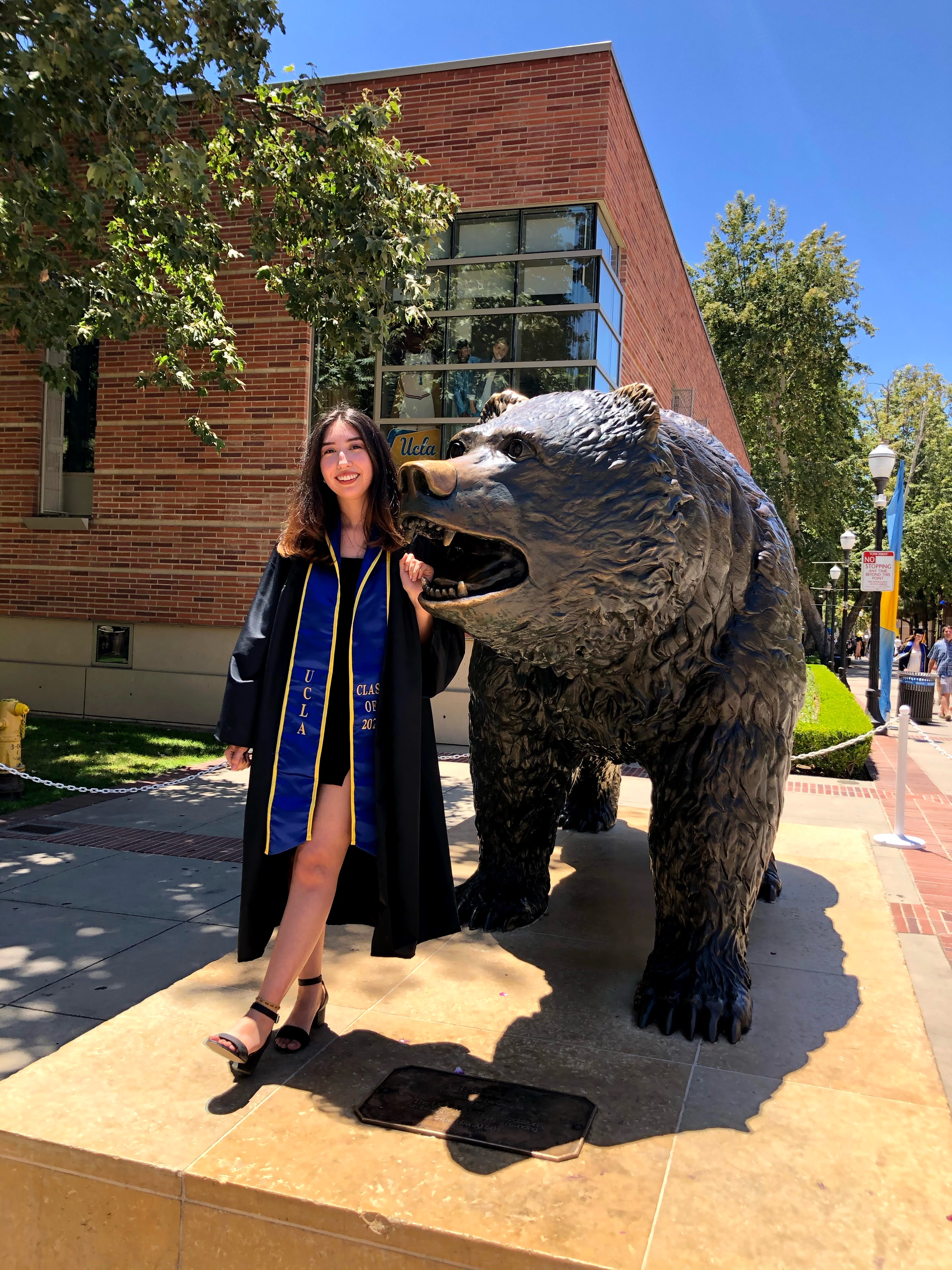
UCLA B.S. Environmental Science, Conservation Biology Minor, IoES Practicum project
This is where everything started (for the most part)!
Admitted as a Chemistry major, I quickly changed my major to Environmental Science after speaking to the Institute of Environmental Science staff and previous IoES students. I was really moved by the staff and their support for their students (at the time it was a very small department, and most of the staff were super involved with everyone).
I was always really interested in the environment, ecology, and conservation growing up, so I felt like I fit right in. Choosing my minor, Conservation Biology, to become my main concentration was my next choice in my academic career. Learning about animal behavior, plant physiology, chemical fate and transport in aquatic systems, forest ecosystems, chemical oceanography, tropical ecology, and all the different types of soils in extreme detail where some of the most fun things I did while working towards my degree.
My last year at UCLA was spent working on my senior project, the Senior Practicum. My group’s project was to create ecological indices for the Los Angeles Sanitation Department. That group effort resulted in published academic paper (my very first!).
Tijuana River National Estuarine Research Reserve
Volunteer work, working with State Parks, working with Southwest Wetlands Interpretive Association (SWIA)
During my last year of college, COVID happened. So, I was fresh out of college and, sadly, no one was hiring.
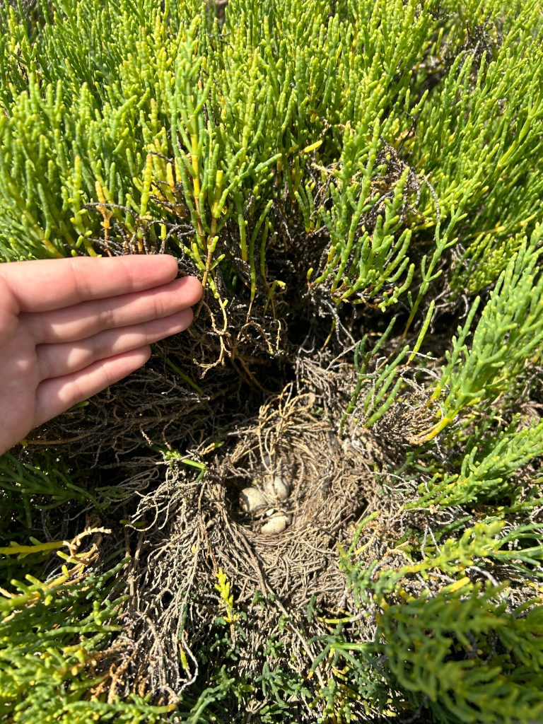
I decided to get experience in any way possible, so I applied to become a volunteer at the Tijuana River National Esturine Research Reserve. Luckily, I got in right away and became a steward volunteer and a research volunteer.
Volunteering taught me a little introduction to plants and birds of California’s coastal wetlands. It also created the connections I needed to land a job at the reserve.
After one year of volunteering, I got a job as a Park Aide for California State Parks. Later that same year, I was also hired as a Research Assistant for the non-profit organization at the park, SWIA.
Since working at the Reserve, I have gotten the chance to learn a lot of methods for data gathering, such as vegetation sampling, soil salinity sampling, fish sampling, and several other methods. I have also gotten the opportunity to teach volunteers and introduce them to many of our projects at the estuary.
I am most grateful for the opportunities I was presented here, and if you are one of my colleagues reading this, thank you.

San Diego Mesa College
Geographic Informational Systems Technician Certificate Program
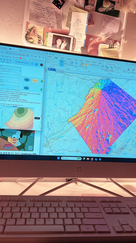
While working at the estuary, I decided my best course of action was to go back to school and get better at one of the skills I learned in college, GIS.
Since starting the certificat program I have taken the following classes:
- GISG 110: Introduction to Mapping and Geographic Information Systems
- GISG 111: Geographic Information Systems and Cartography
- GISG 112: Spatial Analysis with Geographic Information Systems
- GISG 113: Advanced Geographic Information Systems Applications
- GISG 114: Spatial Databases in Geographic Information Systems
And lastly, next semester I will be taking the last course: GISG 270 Geographic Information Systems Work Experience.
Since starting this certificate program, my GIS map-making skill have astronomically improved. I feel a lot more comfortable navigating ArcGIS products and can say I am able to create any map if given enough time to figure out what to do (just kidding, I am almost a professional and know everything).
I have learned where to obtain data for map-making, how to symbolize data so that it’s comprehensible, how to create models, how to normalize data, how to use a vast amount of tools to get my data to display what I want, how to create good layouts, among various other things.
I am very grateful to the staff and fellow classmate whom I got to share this experience with. If it weren’t for them, I don’t think I would have enjoyed learning about GIS as much as I have.
Next Steps
Work I’d like to be involved in and future steps!
Since I’m about to finish my Technician Certificate, I would love to continue working with GIS and, ideally, out in the field.
I am also looking forward to participating in the 30-day Map Challenge in November, as it will be my first time making maps for fun!
In the longer future, I want to be able to implement GIS into conservation projects or urban planning, whether for work or for my own personal projects. I would also like to volunteer more and be able to provide GIS map-making skills when needed.
In the further, most distant future, I am considering going back to college to get a masters in biological conservation (oof) or to study environmental law (OOF). But, for now I just want to keep making maps, and maybe learn some python.
My hobbies!
Some of my personal hobbies and past times are: drawing, painting, watching and reviewing movies, cooking and baking, crocheting, playing video games, hiking, birding, and iNaturalist-ing.
Skills I have learned!
Some skills I have acquired and worked on over the years are: working with GIS and ESRI products, Microsoft Office, R Studio; becoming professionally fluent in English and Spanish, A1 level in German; and obtaining a lot of field research experience.
Want to reach out?
If you’re interested in working with me, or would like to talk about my previous work, send me an email!
valeriaviera.web@gmail.com
